Viewpoints near Foz Côa: the Côa, the Douro and the International Douro
Seventeen confirmed viewpoints around Foz Côa, Torre de Moncorvo, Figueira de Castelo Rodrigo, São João da Pesqueira and Freixo de Espada à Cinta, with coordinates, access and driving times.
In short
Vila Nova de Foz Côa town council has a Viewpoints Route (Rota dos Miradouros) with ten stops. In the town itself are Emílio dos Santos, Caminho da Costa, over the Douro valley, and the Côa Museum viewpoint, over the mouth of the Côa. São Gabriel, at Castelo Melhor, looks over the Côa valley as far as Spain. Penedo Durão, above the International Douro, is 57 km away.
Practical information
- Closest to the quinta
- Emílio dos Santos, 0.9 km (15 min on foot)
- Over the mouth of the Côa
- Côa Museum viewpoint, 1.6 km
- Highest in the municipality
- Senhora do Viso, Custóias, 813 m
- International Douro
- Penedo Durão, 57 km, about 1 hr 20 min
- Best light at Penedo Durão
- Afternoon
- 4x4 recommended
- Barca Velha, Fraga do Cão and Alto da Barca (Moncorvo)
In this article
The viewpoints (miradouros) near Vila Nova de Foz Côa range from the edge of the town, looking over the Douro valley, to the cliffs of the International Douro (Douro Internacional), where the river forms the border with Spain. Foz Côa town council has a Viewpoints Route (Rota dos Miradouros) with ten stops in the municipality; in the town itself are the Emílio dos Santos, Caminho da Costa and Côa Museum viewpoints, the last of them over the mouth of the Côa. Outside the municipality are Penedo Durão, above the International Douro, the Serra da Marofa and São Salvador do Mundo, all 1 hr 20 min or less by car.
Viewpoints near Foz Côa, by distance
Distances and driving times from Quinta Alto da Fraga, in the town, calculated on the OpenStreetMap road network. For viewpoints reached by dirt tracks, the time is approximate.
| Viewpoint | Municipality | From the quinta | What you see | Access | Best light |
|---|---|---|---|---|---|
| Emílio dos Santos | Foz Côa | 0.9 km, 15 min on foot | The surrounding landscape, from a threshing floor with benches next to the chapel of Santa Luzia | In the town | |
| Côa Museum | Foz Côa | 1.6 km, 5 min | The Côa flowing into the Douro | At the museum, during opening hours | Daytime |
| Caminho da Costa | Foz Côa | 2.3 km, 10 min | The Vale da Vila, the Douro and the Serra de Bornes, 45 km away | On the EN102, at the northern exit of the town | Foggy mornings |
| Barca Velha (Açoreira) | Torre de Moncorvo | 10 km, 20 min | The Douro, the mouth of the Sabor and Vale Meão | 4x4 recommended | |
| Mata dos Carrascos (Santo Amaro) | Foz Côa | 11 km, 25 min | Pocinho bridge and dam, Foz Côa and Torre de Moncorvo | 500 m from the village | Morning |
| São Gabriel (Castelo Melhor) | Foz Côa | 14 km, 20 min | The Côa valley, from the Serra da Marofa to Spain | Road up to the chapel | Sunrise and sunset |
| Castelo Melhor castle | Foz Côa | 14 km, 20 min | The Côa valley | Footpath from the village | |
| Santa Bárbara (Mós) | Foz Côa | 15 km, 35 min | A long stretch of the Douro and Monte Meão | 1.5 km from the village | |
| Santa Leocádia | Torre de Moncorvo | 19 km, 30 min | The Vilariça valley, the Serra do Reboredo and the town | Tarmac road | |
| Senhora da Glória (Peredo dos Castelhanos) | Torre de Moncorvo | 20 km, 45 min | The Douro and six chapel viewpoints around it | Road | Sunset |
| São Martinho (Seixas) | Foz Côa | 23 km, 45 min | The Douro around Vesúvio and Numão castle | 2.25 km from the village | Sunset |
| Numão castle | Foz Côa | 26 km, 40 min | The castles of Ansiães, Castelo Melhor, Castelo Rodrigo, Ranhados and Penedono | Footpath from the village | Sunset |
| Senhora do Viso (Custóias) | Foz Côa | 29 km, 40 min | The Douro, São Salvador do Mundo, Numão and São Martinho | 2 km from the village | Sunset |
| Arnozelo (Numão) | Foz Côa | 30 km, 45 min | The Douro up close, at 158 m above sea level | No official information | |
| Serra da Marofa | Figueira de Castelo Rodrigo | 42 km, 60 min | A wide view over the Beira Alta and the Alto Douro | Road to near the top | Sunset |
| São Salvador do Mundo | São João da Pesqueira | 46 km, 55 min | The Douro, the dam and the Cachão da Valeira gorge | Narrow road, little parking | |
| Penedo Durão | Freixo de Espada à Cinta | 57 km, 80 min | The International Douro and the Saucelle dam | Car park and steps | Afternoon |
Where the light column is empty, no source says which way the view faces. On summits with views all round, sunset is the safest choice.
Viewpoints in the town of Foz Côa
There are three, and you can walk to all of them. The Miradouro Emílio dos Santos is next to the chapel of Santa Luzia, in the Aldeia Nova part of town, at 416 m: a threshing floor (eira) with benches facing the landscape, 15 minutes’ walk from the quinta. Caminho da Costa, on the EN102 at the northern exit of the town, has a metal walkway over the slope and an orientation table; the view opens over the Vale da Vila and the Douro as far as the Serra de Bornes, 45 km away. According to the town council, the fog often sits halfway up the slopes, leaving the hilltops, such as Monte Meão, above it.
The Côa Museum viewpoint, at 339 m, looks over the spot where the Côa flows into the Douro, where the region’s two UNESCO World Heritage Sites meet: the Côa Valley rock art and the Alto Douro Wine Region. The museum is open from 9am to 5.30pm from October to April and until 6pm from May to September, and closes on Mondays from 1 November to 31 March. If you are going to see the rock art, there is a guide to visiting the Côa Valley rock art.
Viewpoints over the Douro in the municipality
West of the town, several of the council’s viewpoints stand on hilltops next to chapels that are also part of the Sacred Heights Route (Rota das Elevações Sagradas). In order, starting from the quinta:
- Mata dos Carrascos, in Santo Amaro (11 km, 25 min): a balcony over the Douro, facing the Pocinho bridge and dam. It faces north-east and has the best light in the morning.
- Santa Bárbara, in Mós (5.5 km further, 20 min): 1.5 km from the village, with an 18th-century chapel. You can see such a long stretch of the Douro that a tourist boat stays in view for about 15 minutes.
- São Martinho, in Seixas (12 km further, 40 min): at 638 m, above the Douro around Vesúvio, with vineyards and almond trees all around.
- Senhora do Viso, in Custóias (16 km further, 45 min): at 813 m, the highest viewpoint in the municipality. You can see São Salvador do Mundo to the north-west and Numão castle to the east.
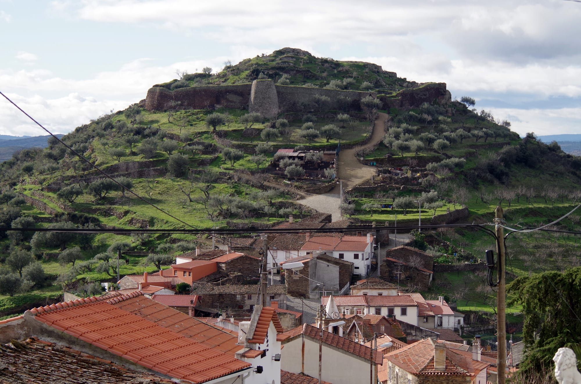
- Numão castle (7.4 km further, 25 min): from the walls you can see the castles of Ansiães, Castelo Melhor, Castelo Rodrigo, Ranhados and Penedono. It is a National Monument.
- Back to the quinta (26 km, 40 min).
The loop is about 80 km and three hours of driving, partly on narrow roads and dirt tracks. Arnozelo is off this loop, far below by the river at 158 m; the council describes it as one of the most impressive settings on the Douro. The villages along the way are in the guide to villages around Foz Côa.
São Gabriel and the Côa valley
The Miradouro de São Gabriel is 1.5 km from Castelo Melhor, next to a chapel at 550 m. The view runs from the Serra da Marofa, with Figueira de Castelo Rodrigo at its foot, to Spain, around Freixo de Espada à Cinta, and takes in Almendra, Foz Côa and Castelo Melhor with its castle. From the highest point of the hill, at 654 m and about 1 km away, you can see the whole Côa valley, land in six neighbouring municipalities from Torre de Moncorvo to Trancoso, and Castile on the Spanish side. Further down there is a picnic area. The São Gabriel pilgrimage (romaria) is on the Monday after Easter Sunday (29 March in 2027).
Castelo Melhor is also the starting point for the afternoon Penascosa visits and for the night visit, so you can combine São Gabriel and the rock art at the end of the same day. In the almond blossom season, the Castelo Melhor almond orchard is one of the stops on CP’s train programme.
Torre de Moncorvo: Santa Leocádia and Senhora da Glória
On the Moncorvo side, the Miradouro de Santa Leocádia, above the town, has a tarmac road and views of the Vilariça valley and the Serra do Reboredo. From the Senhora da Glória viewpoint, in Peredo dos Castelhanos, you can see the Douro and six of the region’s chapel viewpoints. The Barca Velha, Fraga do Cão and Alto da Barca viewpoints, the last of them over the mouth of the Côa, are reached by tracks for which the town council recommends a 4x4.
International Douro: Penedo Durão
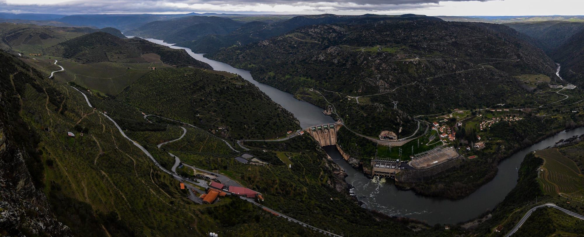
Penedo Durão is in Poiares, Freixo de Espada à Cinta, inside the International Douro Natural Park (Parque Natural do Douro Internacional). The road ends at a car park next to the viewpoint, and from there steps lead down to a terrace. Below, the Douro forms the border between vineyards, olive groves and cliffs, with the Spanish Saucelle dam in view. It is also a place to watch birds of prey: griffon vultures, Egyptian vultures, short-toed snake eagles and peregrine falcons. The viewpoint faces east: the light over the valley is better in the afternoon, and the cliff itself only gets the sun in the morning.
It is 57 km from the quinta, about 1 hr 20 min, and you can combine it with Barca d’Alva, 16 km away, on the same day.
Serra da Marofa and São Salvador do Mundo
The Serra da Marofa, in Figueira de Castelo Rodrigo, rises to 977 m, and the town council describes it as a natural viewpoint with a view that reaches a very long way. At the top are the chapel of Nossa Senhora de Fátima, built in 1957, which locals call Senhora da Marofa, and a statue of Christ the King.
São Salvador do Mundo, in São João da Pesqueira, is the largest sanctuary in the Alto Douro Wine Region: a group of small chapels spread across the hillside, the oldest from the 16th century. You can see the Douro, the Valeira dam and the Cachão da Valeira, the gorge where Baron Forrester died. The access road is narrow and parking is limited, so the town council advises coming by car or in a small van.
From Quinta Alto da Fraga
The closest of all is the town’s small Santa Bárbara viewpoint on Rua da Lameira, 200 metres from the quinta (not the one at Mós). You can walk from the quinta to the town’s three viewpoints: Emílio dos Santos is 15 minutes away, the Côa Museum 25 (only during museum opening hours) and Caminho da Costa about half an hour. For an afternoon, São Gabriel is 20 minutes by car and fits in after the Penascosa visit. The chapel loop over the Douro, with about 3 hours 15 minutes of driving, takes up the day. Penedo Durão needs a full day, ideally with the loop through Castelo Rodrigo and Barca d’Alva and reaching the viewpoint in mid-afternoon.
Frequently asked questions
Which is the most beautiful viewpoint near Foz Côa?
It depends on what you want to see. For the Côa flowing into the Douro, the Côa Museum viewpoint, 1.6 km from the quinta. For the Côa valley as far as Spain, São Gabriel, at Castelo Melhor. For the International Douro and birds of prey, Penedo Durão, in Freixo de Espada à Cinta, about 1 hr 20 min away by car.
Where is the Penedo Durão viewpoint and how do you get there?
It is in Poiares, in the municipality of Freixo de Espada à Cinta, inside the International Douro Natural Park. The road ends at a car park next to the viewpoint, and from there steps lead down to the terrace. From Vila Nova de Foz Côa it is 57 km, about 1 hr 20 min.
Which Foz Côa viewpoints can you walk to from the town?
Three: the Miradouro Emílio dos Santos, next to the chapel of Santa Luzia; Caminho da Costa, at the northern exit of the town on the EN102; and the Côa Museum viewpoint. From Quinta Alto da Fraga they are about 15, 30 and 25 minutes' walk respectively.
Are there viewpoints where you can see the sea of clouds in the Douro valley?
Yes. On foggy winter mornings the valley fills with cloud and the viewpoints on the plateau stand above it. The town council notes that at Caminho da Costa the fog often sits halfway up the slopes, leaving peaks such as Monte Meão sticking out. Fog is most frequent from November to January.
Sources
- Vila Nova de Foz Côa Municipality, Explore Foz Côa, Viewpoints Route (Rota dos Miradouros)
- Vila Nova de Foz Côa Municipality, Explore Foz Côa, Sacred Heights Route (Rota das Elevações Sagradas)
- Vila Nova de Foz Côa Municipality, Explore Foz Côa, Castles
- Vila Nova de Foz Côa town council, tourist map of the town and municipality
- Fundação Côa Parque, opening hours and prices
- Torre de Moncorvo town council, Miradouro Barca Velha
- Torre de Moncorvo town council, Miradouro de Santa Leocádia
- Torre de Moncorvo town council, Miradouro da Senhora da Glória
- Torre de Moncorvo town council, Miradouro da Fraga do Cão
- Torre de Moncorvo town council, Miradouro do Alto da Barca
- São João da Pesqueira town council, Miradouro de São Salvador do Mundo
- Figueira de Castelo Rodrigo town council, points of interest (Serra da Marofa)
- Birdingplaces, Penedo Durão
- Wikipedia (Portuguese), Castelo de Numão
- Wikipedia (Portuguese), Castelo de Castelo Melhor
- Wikipedia (Portuguese), Parque Natural do Douro Internacional
Stay in the middle of the Côa Valley
Four rooms on a quinta with a pool and views over the valley, 1.6 km from the Côa Museum. Rated 9.8 on Booking.com. Ask the hosts directly for availability.
Keep planning
-
-
-